rdtamu

Rashmi Dangol
I am Rashmi Dangol, a research assistant at Texas A&M University, where I work on sensor-based detection of weed species in rangelands. My projects focus on remote sensing, including UAV and satellite data, as well as the development of computer vision and machine learning approaches, contributing to sustainable rangeland management. I am skilled in acquiring, processing, analyzing, and visualizing spatial data to provide meaningful insights that help industries make informed and impactful decisions.
You can visit my LinkedIn profile here.
Technical Skills: Python, ArcGIS Pro, Pix4DMapper, SAS, Microsoft Office
Education
-
Graduate Certificate in GIS Texas A&M University, College Station, TX (2025) -
M.S., Agriscience Illinois State University, Normal, IL (2024) -
B.S. Agriscience Agriculture and Forestry University, Nepal (2020)
Work Experience
Research Assistant
- Conducted GIS and Remote Sensing-based research experiments for precision agriculture and utilized satellite imagery and remote sensing software to evaluate forest and pasture lands
- Developed and trained a computer vision model (YOLO) for the automated detection of weed species in pastures using proximal imaging
Product Placement Phenotyping Intern @ Syngenta
- Created geospatial field maps, led flight operations, and analyzed high-resolution aerial images using a DJI Matrice 300 RTK drone for corn emergence
- Developing a machine-learning-based image processing pipeline and analyzing data to have the first model estimators using Python
Seed Technology Intern @ Bayer
- Coordinated data collection for soil testing and analysis using the Smart Farm Plus application and created Latin America (LATAM) seeds technical sheets
Digital Enumerator/Surveyor @ International Maize and Wheat Improvement Center (CIMMYT)
- Led a team of six members to conduct baseline and end-line surveys using Kobo_Toolbox for the Beneficiary-Based Survey of the National Seed and Fertilizer Project (NSAF) to understand the effectiveness of ICT tools in agriculture in Nepal
Map of Texas A&M University, College Station
Interactive graph showing average precipitation in Austin, TX from 2007-2026
Esri Imagery showing Boundary of Tubarjal valley
Plotting NDVI Changes in Tubarjal Valley Saudi Arabia
Projects
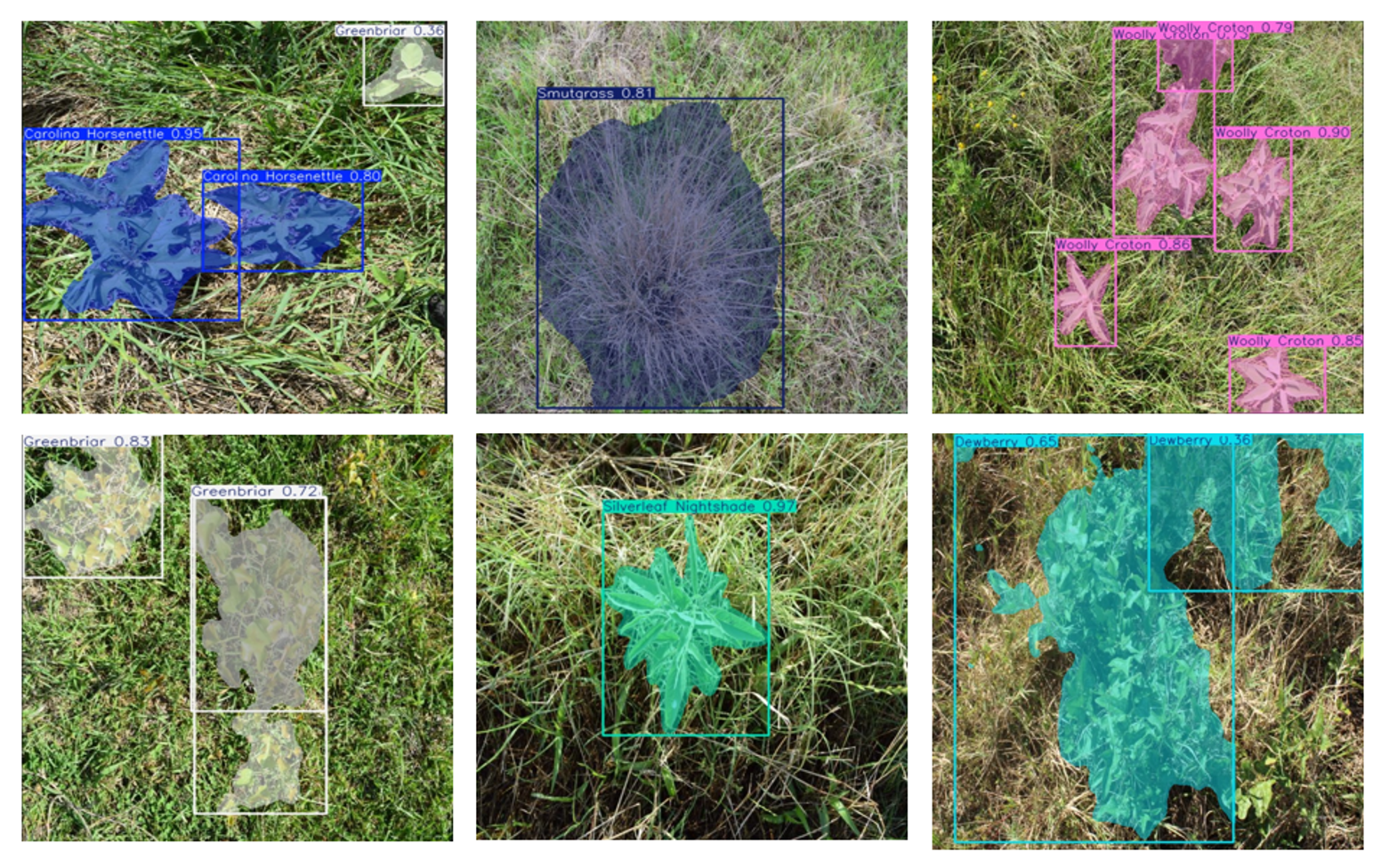
Weed Recognition with Deep Learning Approaches
Developed and evaluated a deep learning-based weed identification system for recognizing six common and invasive weed species in pastureland in digital images.
Technical Approach
Detection and Segmentation Model: Comparing the performance of various deep learning architectures:
- YOLOv8 (You Only Look Once, version 8)
- YOLOv11 (You Only Look Once, version 11)
- RT-DETR (Real-Time Detection Transformer)
Remote Sensing-based Classification in Pastureland
Monitored the spatial distribution of weeds and implemented classification models for weed mapping
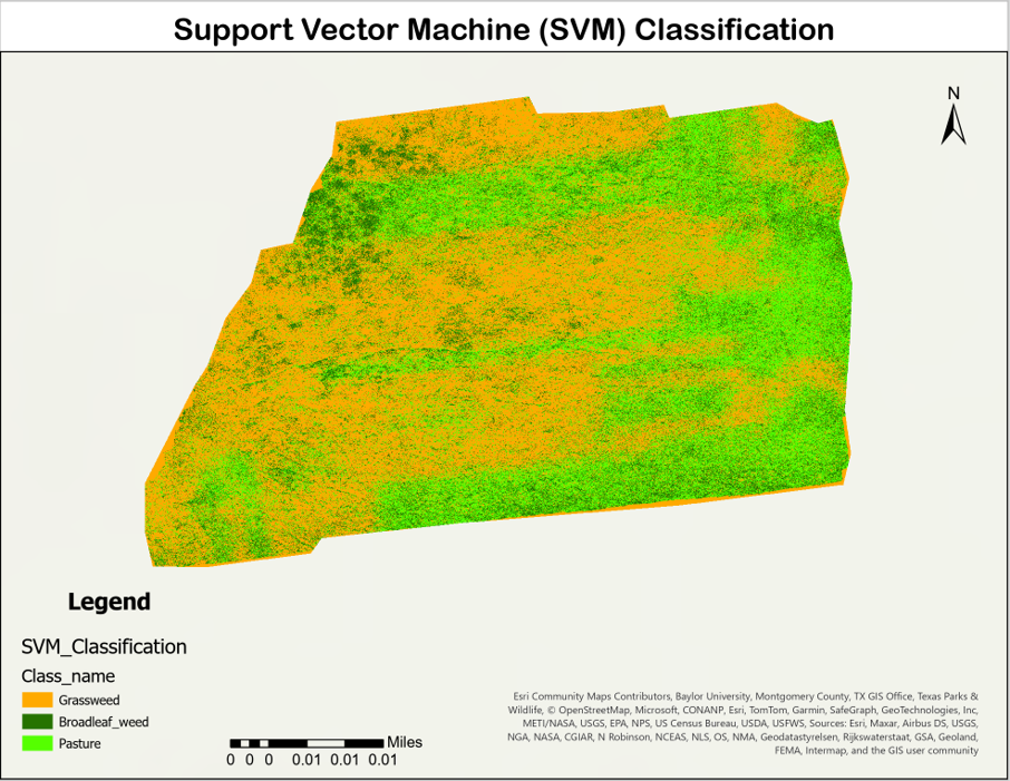
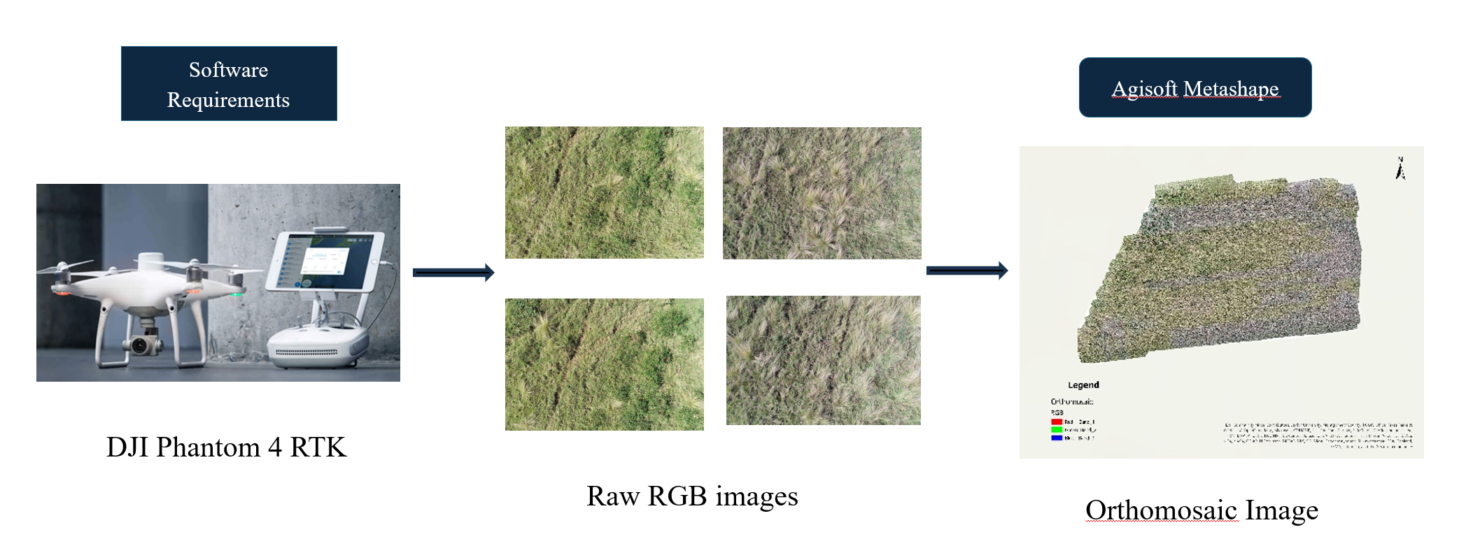 Vegetative Indices such as Excess Green Index (ExG) and Normalized Green-Red Difference Index (NGRDI) were calculated, and a Support Vector Machine model was chosen for classification in ArcGIS Pro.
Excess Green Index (EGI) Map

Highlights vegetation using RGB-based index derived from drone imagery
Classification Map- Support Vector Machine (SVM)
Flood Analysis through Soil and Satellite Data in Kerr County, TX
Analyzed flood dynamics by integrating satellite data, land cover, and soil moisture data.
Land Cover Classes in Kerr County
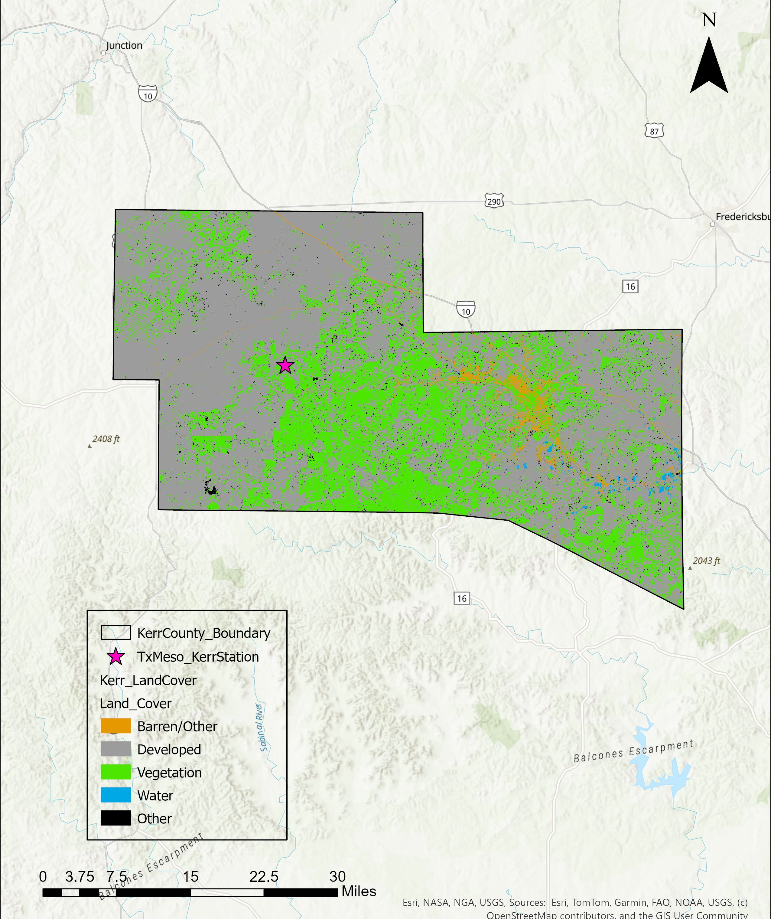
Land Cover Distribution